
FOR SALE – Oakfield Farm, Easton Piercy, Kington St. Michael, Chippenham, Wiltshire, SN14 6JU
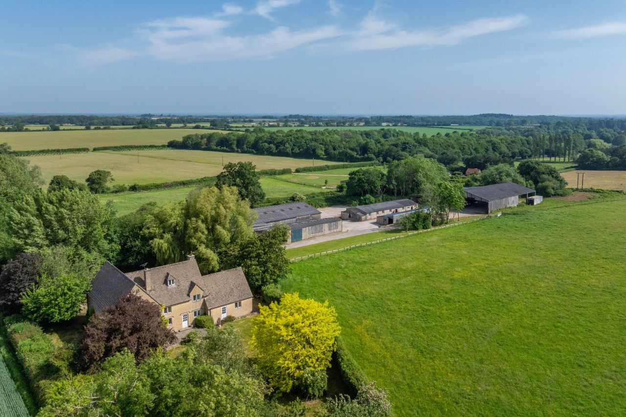
Oakfield Farm, Easton Piercy, Kington St. Michael, Chippenham, Wiltshire, SN14 6JU
Chippenham – 4 miles, M4 Junction 17 – 5 miles, Chippenham Train Station – 5 miles
Offers Above £1,600,000
“A beautifully designed spacious family home nestled in the Wiltshire countryside with adjoining land and buildings”
INTRODUCTION
Oakfield Farm provides an exceptional opportunity to purchase a detached five-bedroom property set in a large, well-maintained garden, which benefits from a substantial range of agricultural buildings, concrete yard and permanent pasture fields. In total the property extends to approximately 14.03 acres. The property is brought to the market for the first time since it was built in the early 1990s.
The farmhouse offers exciting scope for an incoming purchaser to create a truly exceptional country home in a beautiful setting. The buildings provide potential opportunities for a range of alternative uses (subject to planning).
SITUATION
Oakfield Farm sits in a rural position on the edge of the hamlet of Easton Piercy, between the villages of Kington St. Michael and Yatton Keynell, which both feature primary schools, village halls, churches and pubs. The property is located within the charming Wiltshire countryside with beautiful views overlooking rural scenery to the rear. Oakfield Farm benefits from complete privacy, with the adjoining pastureland under the same ownership and mature trees providing privacy to the house. This allows for plenty of space and tranquillity whilst being in a peaceful location and a short drive from various amenities.
Oakfield Farm is in a sought-after position, being within easy reach of the market town of Chippenham, a 12-minute drive away. The popular city of Bath can be reached in around 30 minutes. Both offer a very good choice of shopping and amenities, accompanied by excellent restaurants and cafes. In addition, the famous Cotswold village of Castle Combe is located nearby. The area is particularly well served by a wide selection of highly regarded state and independent schools, catering for all age groups. The property is extremely well connected, being around 12 minutes from Junction 17 of the M4. Trains to London Paddington run regularly from Chippenham, with a journey time of around 75 minutes.
FARMHOUSE & GARDEN
Oakfield Farm was built in the early 1990s and comprises an attractive Cotswold stone farmhouse, under a tiled roof, and is double glazed throughout. The farmhouse is subject to an Agricultural Occupancy Condition (AOC).
The farmhouse is in great condition throughout but offers an excellent opportunity for sympathetic updating, providing an exciting opportunity for an incoming purchaser to adapt the farmhouse to their own taste to create an excellent family home. The Gross Internal Area of the house extends to approximately 3,925 sq.ft (364.6 sqm).
Ground Floor – The principal door opens into a large entrance hall which leads to the kitchen/breakfast room, formal dining room, sitting room and WC. Leading on from the kitchen is a utility room, store room, office, a second WC and back porch. The staircase rises from the hallway leading to…
First Floor – …the landing which leads to five good-sized double bedrooms, a family bathroom and good-sized airing cupboard. Three of the bedrooms have en-suite bathrooms, with four having built-in storage. The landing houses a second set of stairs which leads to…
Second Floor – …the attic, which is currently split as two large rooms. This has been used for storage but has good head height and provides excellent potential for additional living space, be it additional bedrooms, office/work space, play room or games room.
Externally there is a large, established, well-kept garden of approximately 0.37 acres. The garden has been carefully landscaped to complement both the farmhouse and its rural setting arranged over two levels. The property boasts a circular driveway, and the house is surrounded by mature trees, creating an impressive arrival to the property and offering ample parking and turning space. In all, this section of the property totals 1.08 acres including garden, driveway, and parking.
Agricultural Occupancy Condition (AOC) – the farmhouse is subject to an AOC. Planning permission was granted for the farmhouse on 8th February 1990 (planning ref. N/89/03266/FUL) subject to the following wording “the occupation of the dwelling hereby permitted shall be limited to a person solely or mainly employed, or last employed, in the locality in agriculture, as defined in Section 290(1) of the Town & Country Planning Act, 1971, or in forestry, including any dependents of such a person residing with him, or a widow or widower of such a person”. The AOC has been complied with since the property was built.
LAND
The land comprises two fields of permanent pasture, extending to 10.40 acres, which have been used for grazing and hay. Boundaries are marked by either mature hedgerows or sheep net fencing. The land is mainly level and benefits from good vehicular access. Historically, there has been a second access off Cromhall Lane to Field 2. The land is Grade 3 quality and benefits from a few small ponds across the property. The soil type is lime-rich loamy and clayey soil. The land presents a range of opportunities to anyone with agricultural, equestrian or amenity interests, subject to the relevant planning permissions.
BUILDINGS
Situated to the north of the property, the farmyard includes a range of steel portal frame and block-built buildings with concrete or hardcore floors, accessed from a large open yard laid to concrete and hardcore. Originally, Oakfield Farm was used as a pig rearing unit. The buildings offer various opportunities for future uses, including equestrian or commercial, subject to obtaining necessary planning consents.
DEVELOPMENT OVERAGE
The agricultural buildings at Oakfield Farm are offered for sale subject to an overage provision should the buildings be redeveloped for residential use. The provision will apply on the granting of planning permission. The details of the overage are to be discussed and agreed with the Vendor, but it is likely it will last for 25 years and require payment of 25% of the increase in value.
VIEWINGS
All viewings are strictly by prior appointment. Viewings should be arranged through WebbPaton on: 01793 842055, helen@webbpaton.co.uk or laura@webbpaton.co.uk
FOR SALE – Woodland at Jacksdale, Ashfield, Nottingham, DE55 4PE
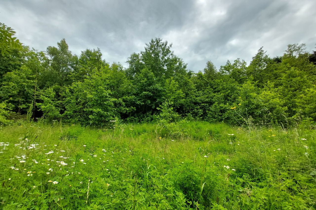
FOR SALE – WOODLAND AT JACKSDALE, ASHFIELD, NOTTINGHAM DE55 4PE (approx. postcode)
Approximately 10 acres of woodland for sale
Freehold with Vacant Possession
OFFERS IN EXCESS OF £150,000
Jacksdale – 2.3 miles | Alfreton – 3 miles
(All distances are approximate)
Land Details
A fantastic opportunity to purchase approximately 10.23 acres of woodland in Jacksdale, Nottingham. The woodland comprises mixed native trees of which some are natural growth and some having been planted approximately 20 years ago.
The woodland benefits from direct access from Alfreton Road. The woodland is bordered by the railway line and to the south the site adjoins a public right of way. The site was formerly part of the railway cutting but it is noted that no fill was put on site. The southern boundary of the land borders the Smotherly Opencast. The land is included with the SJU037 SHELAA site.
The land is subject to the following designations:
- Green Belt (EV1)
- SHELAA Site – SJU037
Access
Access to the woodland is obtained from Alfreton Road. The site benefits from a dropped curb.
Services
It will be the responsibility of the purchaser to investigate whether any other services can be made available.
Location
The land is located in an attractive position, approximately 2.3 miles north west of Jacksdale and is marked with a red circle on the location plan overleaf.
Rights of Way and Easements
As far as we are aware, there are no other rights of way or easements crossing the land.
Sporting & Mineral Rights
The Sporting & Mineral Rights are in hand and included in the sale so far as they are owned.
Method of Sale
The freehold of the property is offered for sale as a whole by Private Treaty moving to Informal Tender if necessary. Closing date for all enquiries and offers by 12pm on 12 September 2024.
Viewings
Interested parties may walk the land at any time during daylight hours provided they carry a copy of the particulars with them. Interested parties are responsible for their own safety.
Directions
From Selstone, head along the B600 towards Alfreton. The woodland can be found on the left handside before the Railway bridge (Pye Bridge). The land will be marked with a ‘For Sale’ board.
Enquiries and Further Information
All enquiries should be made to Felicity Wright at WebbPaton. Telephone: 01793 842055. Email: felicity@webbpaton.co.uk.
Uplift/Development Clause
The property will be sold subject to an uplift clause whereby the current vendors will receive 30% of any increase in value upon the granting of planning permission for residential and commercial development over a period of 25 years, from when the property is sold.
Data Room
An online data room is available for the sale. Please contact WebbPaton for access.
Agents Note
The seller will retain the area coloured yellow on the attached plan
What3Words
///cheeks.poodle.magnitude
SOLD – Land at Worton, Devizes, Wiltshire, SN10 5SH
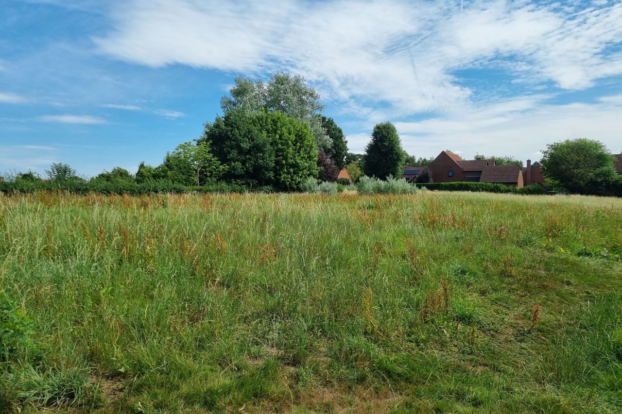
LAND AT WORTON, DEVIZES, WILTSHIRE, SN10 5SH (approx. postcode)
SOLD
A 1.42-acre grass paddock in the middle of the village, offering long-term planning potential
OFFERS IN EXCESS OF £70,000
Potterne –1.9 miles | Devizes – 3.6 miles | Market Lavington – 3.8 miles (All distances are approximate)
Land Details
An attractive parcel of land situated in the desirable Wiltshire village of Worton, offering a variety of uses including amenity, equestrian, garden extension or long-term potential for residential development (all subject to the necessary planning consents). The parcel backs onto existing residential properties, the primary school and the church, presenting a unique opportunity for neighbouring properties to potentially extend.
The land is primarily grassland with a scattering of mature trees and well-established boundary hedgerows, providing privacy and natural character. The land benefits from post and wire fencing on the southern boundary, separating the public footpath, which is part of the property, from the land.
The land is classified as Grade 3, with slowly permeable seasonally wet slightly acidic but base-rich loamy and clayey soils. A small section of the eastern boundary is located within a Nitrate Vulnerable Zone.
Access
Vehicular access to the land is obtained from a gateway off Cedar Close through a right of way. On foot, there are three access points from public footpaths.
Services
No services are currently connected. It will be the responsibility of the purchaser to investigate whether services can be made available.
Location
The land is located in an attractive position, in the middle of the village of Worton and is marked in red on the location plan overleaf.
Rights of Way & Easements
Two public footpaths cross the site (WORT13 and WORT14), enhancing local connectivity and rural charm. As far as we are aware, there are no other rights of way or easements crossing the land.
Sporting & Mineral Rights
The sporting and mineral Rights are in hand and included in the sale so far as they are owned.
Method of Sale
The freehold is offered for sale as a whole by Informal Tender. All offers must be submitted in writing on the Tender Offer form to laura@webbpaton.co.uk by 12 Noon on Wednesday 19th November 2025.
Viewings
Interested parties may walk the land at any time during daylight hours provided they carry a copy of the particulars with them. Interested parties are responsible for their own safety.
Directions & What3Words Locations
The land is located in Worton village, from the High Street turn into Cedar Close. A footpath access is almost immediately on your right: ///armful.bounding.internet. Alternatively, continue along Cedar Close, turn right, follow the road round to the right where gated access is available: ///precluded.couches.strength. Alternatively, turn from the High Street into Church Lane, continue to the end of the road, next to the Church. Follow the footpath which runs behind the Church and an access to the land is on your left: ///barbarian.whistle.tabs. The land will be indicated with ‘For Sale’ boards.
Enquiries and Further Information
The vendor is not obliged to accept the highest or indeed any offer for the land. All enquiries should be made to Laura Carpenter or Helen Wiltshire at WebbPaton. Telephone: 01793 842055. Email laura@webbpaton.co.uk or helen@webbpaton.co.uk
Data Room
An online data room is available for the sale. Please contact WebbPaton for access.
SOLD – Land at Batheaston, Bath, BA1 8ES
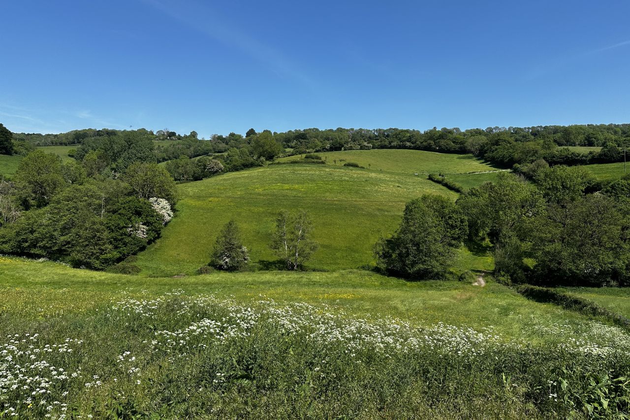
36.91 acres of grassland set in the stunning Cotswolds National Landscape
Freehold with Vacant Possession
OFFERS IN EXCESS OF £300,000
Batheaston – 1 mile | Bath City Centre – 4 miles
(All distances are approximate)
Land Details
A unique opportunity to purchase a ring fenced block of grassland on the outskirts of Bath/Batheaston located in the beautiful valley St Catherine. The land extends to approximately 36.91 acres (14.94 hectares), currently being used for agricultural purposes.
The tranquil nature of the property boasts an array of wildlife and spectacular far reaching views over the surrounding valley and the famous Solsbury Hill. The property would suit a range of alternative uses for those with equestrian, environmental or amenity interests. Necessary consents may be required.
The land is Grade 3/4 land classification, with lime-rich loamy and clayey soils. The land benefits from roadside access and is enclosed by mature hedgerows, livestock fencing and dry stone walls.
Access
Access to the land is obtained from a gateway in the south western corner from the public road known as Northend.
Services
All fields benefit from water troughs which are supplied by natural springs. Wessex Water are responsible for maintaining these supplies.
Location
What3Words: ///Lordship.Equity.Triads
Marked with a red circle on the location plan.
Rights of Way and Easements
The land is subject to two public footpaths, one overhead electricity line and a number of natural springs which are maintained and operated by Wessex Water. In addition, there are a number of mains water pipes that run under the land.
Sporting & Mineral Rights
The Sporting & Mineral Rights are in hand and included in the sale so far as they are owned.
Tenancies and Agreements
The land is currently subject to a Grazing and Mowing Licence. Vacant Possession will be available on completion.
Designations and Environmental Matters
The land lies within the Cotswolds National Landscape and a Greenbelt. The land either side of St Catherine’s Brook is also designated as being in a level 2/3 Flood Zone.
Method of Sale
The freehold of the property is offered for sale as a whole by private treaty with vacant possession.
Viewings
Interested parties may inspect the land at any time during daylight hours provided they carry a copy of the particulars with them. Interested parties are responsible for their own safety.
Directions
From Batheaston Village Hall take the road known as Northend and head north out of the village. After approximately one mile there will be a layby on the right. The access to the property is located at this layby marked with a For Sale Board.
Enquiries and Further Information
All enquiries should be made to George King at WebbPaton, The Dairy, Hook SN4 8EF. Telephone: 01793 842055. Email: gking@webbpaton.co.uk
SOLD – Land at Webbs Wood, Brinkworth, SN15 5EF
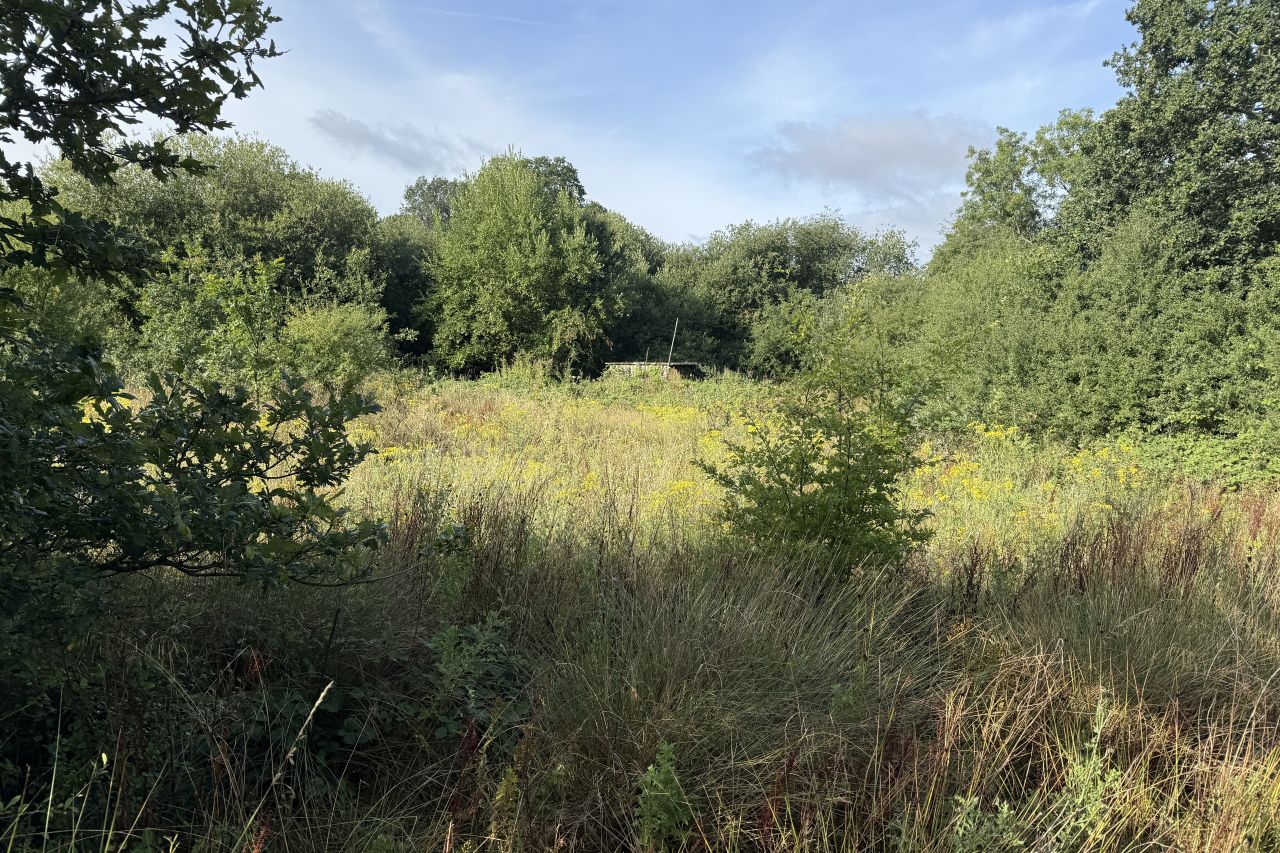
SOLD STC – Land At Webbs Wood, Brinkworth, SN15 5EF (approx. postcode)
6.68 acres (2.70 hectares) of land
Freehold with Vacant Possession
OFFERS IN EXCESS OF £85,000
Royal Wootton Bassett – 2.5 miles | Malmesbury – 6 miles |Swindon City Centre – 7 miles (all distances are approximate)
Land Details
A unique opportunity to purchase a single parcel of land which benefits from two buildings historically used for agricultural and storage purposes. The property is surrounded by a mixture of boundary hedgerows and mature trees and some fencing. Currently overgrown, the land has previously supported a range of small scale agricultural enterprises, however it is being offered free from overage clauses and could be suitable for a variety of alternative uses, subject to obtaining the necessary consents. These may include equestrian, environmental or amenity purposes.
Access
Access to the property is obtained from the public highway to the north known as Wood Lane. The entrance to the property is located on the left hand side of the single access track leading to Webbs Wood from Wood Lane.
Services
The property benefits from a mains water connection. As far as we are aware, the property does not benefit from any other services.
Location
What3Words: https://w3w.co/hoped.encloses.perch
Marked with a red circle on the location plan.
Rights of Way and Easements
The access to the property is subject to a bridleway. As far as we are aware, there are no other rights of way or easements crossing the property.
Sporting & Mineral Rights
The Sporting & Mineral Rights are in hand and included in the sale so far as they are owned.
Tenancies and Agreements
The property is owner occupied. Vacant Possession will be available on completion.
Designations and Environmental Matters
The neighbouring woodland known as Webbs Wood, is designated as an ancient woodland. The western part of the property adjoining Wood Dridge Brook lies within a level three flood zone. The property has an Agricultural Land Classification of Grade 4.
Method of Sale
The freehold of the property is offered for sale as a whole by private treaty with vacant possession.
Viewings
Interested parties may inspect the land at any time during daylight hours provided they carry a copy of the particulars with them. As the property is overgrown and dilapidated in areas, interested parties are requested to be exceptionally careful and vigilant when viewing the property. The vendor and their selling agents cannot be held liable for any injuries sustained during viewings. All viewing parties are reminded it is their decision as to what they deem safe to inspect and to do so is at their own risk.
Directions
From junction 16 of the M4, take the A3102 signposted to Royal Wootton Bassett. At the roundabout, take the second exit onto Swindon Road to Royal Wootton Bassett. At the next roundabout, take the second exit onto the A4042/Brinkworth Road signposted to Malmesbury. Follow this road for approximately 2.8 miles until you reach the Callow Hill crossroads. At the crossroads, take the right turn onto Wood Lane heading north. After half a mile, the access to the property will be on the right hand side. Proceed down the access track and after 100m the entrance to the property will be on the right hand side.
Enquiries and Further Information
All enquiries should be made to George King at WebbPaton, The Dairy, Hook SN4 8EF. Telephone: 01793 842055. Email: gking@webbpaton.co.uk
SOLD – The Rosiers, Wood Street, Clyffe Pypard, Wiltshire, SN4 7PZ
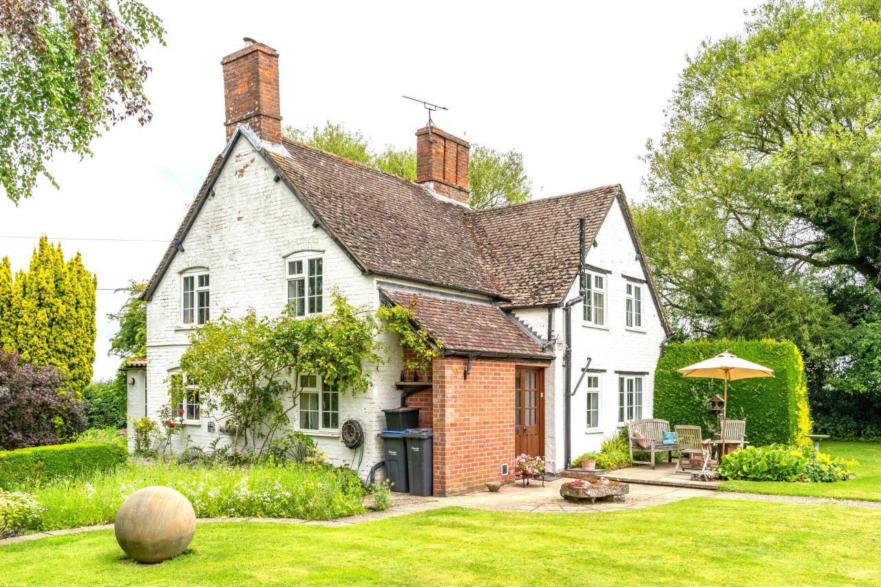
SOLD – THE ROSIERS
Wood Street, Clyffe Pypard, Swindon, Wiltshire, SN4 7PZ
Royal Wootton Bassett – 4 miles, Marlborough – 11 miles, M4 Junction 16 – 6 miles, Swindon Train Station – 10 miles
Offers in excess of: £795,000
Available as a whole or in two lots
“An exceptional opportunity to purchase a detached period property set in 8.42 acres”
INTRODUCTION
The Rosiers is situated in a quiet and private rural position, located on the edge of the village of Clyffe Pypard with surrounding scenic views of the Marlborough Downs. The property lies a short distance from the market town of Royal Wootton Bassett, which provides a range of local services plus access to Junction 16 of the M4. The nearby village of Broad Hinton contains a primary school, village hall, church, pub and restaurant.
The Rosiers provides an exceptional opportunity to purchase a detached four-bedroom period property set in a large, well-maintained garden with double garage, workshop and adjoining permanent pasture field of approximately 8.03 acres. In total the property extends to approximately 8.42 acres. The property is brought to the market for the first time in 37 years.
With potential to renovate and remodel the cottage (subject to planning) which is not listed, The Rosiers provides an opportunity to create an exceptional family home in a beautiful setting.
SITUATION
The Rosiers sits on the edge of the village of Clyffe Pypard, located within the charming Wiltshire countryside with beautiful views overlooking rural scenery to the rear of the property. The Rosiers benefits from complete privacy being bordered by hedgerows, with the adjoining pasture land under the same ownership. This allows for plenty of space and tranquillity whilst being in a village location a short drive from various amenities.
The Rosiers is in a sought-after position, being within easy reach of the vibrant market town of Royal Wootton Bassett, a 10-minute drive away. The popular town of Marlborough can be reached in around 20 minutes. Both towns offer a very good choice of shopping and amenities, accompanied by excellent restaurants and cafes. There is a range of particularly good schools in the local area. The property is extremely well connected being around 11 minutes from Junction 16 of the M4, which leads to the M5 or the A419. Trains to London Paddington run regularly from Swindon, with a journey time of around 55 minutes.
LOT 1 – GUIDE PRICE £670,000
The Rosiers dates back around 300 years and is an attractive, period cottage constructed of painted red brick, under a tiled roof, and is double glazed throughout. On the ground floor the principal door opens into the porch, which leads to the kitchen/family room. The ground floor also includes a dining room, sitting room, two further porch areas, one used as a laundry/utility room, and shower room. The staircase rises from the dining room which leads to a “U”-shaped landing. The landing leads to three double bedrooms (one of which has a dressing room), a single bedroom and family bathroom. Externally there is a large, established, well-kept garden of approximately 0.39 acres, with a variety of flower borders, vegetable beds and a large lawn. There is a private driveway with parking for multiple cars and a layby off the road for parking with steps leading up to the property. The property also boasts a large double garage and workshop, greenhouse, and dilapidated outhouse that could be repaired and repurposed for alternative uses subject to the necessary consents.
The cottage is in a great condition but may benefit from some modernisation throughout, offering a rare and exciting opportunity to renovate an unlisted property to create an excellent family home. The Gross Internal Area of the house extends to approximately 1,682 sqft (156.2 sqm).
LOT 2 – GUIDE PRICE £125,000
The land consists of a single field parcel of permanent organic pasture, extending to 8.03 acres, which has been used for forage production. Boundaries are marked by mature hedgerows. The land is mainly level albeit sloping gently downwards to the north. The land benefits from vehicular access from the southwest border, directly off the public highway, with pedestrian access from the rear of the garden. The land is Grade 3 quality and benefits from a small pond on the northeast border. The land presents a range of opportunities to anyone with agricultural, equestrian or amenity interests, subject to the relevant planning permissions. The land is currently subject to an environmental scheme, please ask the agent for more information.
COVENANT
The sale will be subject to a covenant on the land preventing any future residential development.
SERVICES
The cottage is connected to a mains water supply,
mains electric and septic tank drainage. Central heating and cooking is provided by an oil-fired Rayburn. We understand the property benefits from a good broadband connection.
METHOD OF SALE
The property is offered for sale as a whole or in two lots by private treaty. The Vendors’ preferred route is a sale as a whole.
TENURE AND POSSESSION
The property is offered for sale freehold with vacant possession on completion.
COUNCIL TAX & LOCAL AUTHORITY
The farmhouse is in Band G for Council Tax purposes. The relevant local authority is Wiltshire Council at www.wiltshire.gov.uk
PUBLIC RIGHTS OF WAY
There is a public footpath (CPYP24) crossing the land which runs from the field entrance to the northern corner.
DIRECTIONS
When travelling from Royal Wootton Bassett or Lyneham, at Withy Bed, take the turning into Wood Street and continue for approximately 660m. The property will be on your left. When travelling from Clyffe Pypard, pass the church on your right, continue for 0.6 miles, and the property will be on your right. You will note a double garage in front of you, please park here.
VIEWINGS
All viewings are strictly by prior appointment. Viewings should be arranged through WebbPaton on 01793 842055
SOLD – Land & Buildings At Packhorse Lane, Purton, Swindon, Wiltshire, SN5 4HU
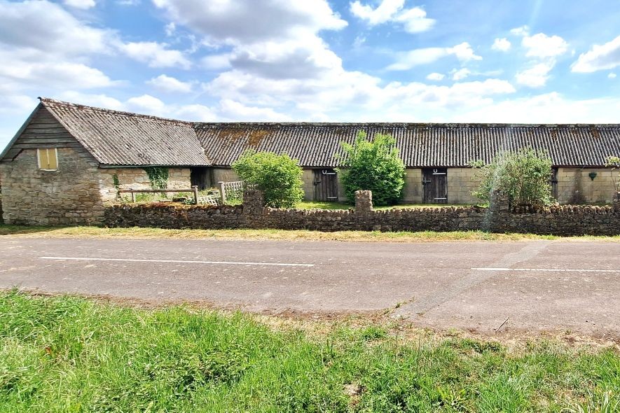
SOLD
**Updated 3rd June 2025, due to significant interest in the property, the tender deadline is being brought forward to 12 Noon on Friday 13th June 2025**
Land And Buildings At Packhorse Lane, Purton, Swindon, Wiltshire, SN5 4HU (approx. postcode)
A 2.76 acre grass paddock with charming old stone stables and garage, offering planning potential for sale by Informal Tender – Freehold with Vacant Possession
OFFERS IN EXCESS OF £150,000
Land Details
An attractive single parcel of productive grassland extending to approximately 2.76 acres situated close to Purton, Wiltshire. The land benefits from traditional stone stables and garage, offering potential for residential development, subject to obtaining necessary planning consents. This site represents a rare opportunity for buyers seeking land and buildings for a range of opportunities to anyone with equestrian or amenity interests. The land benefits from mature hedgerow boundaries, some stock fencing and two direct access points from the public highway. The land is classified as Grade 3 to the north-east and Grade 4 to the south-west over base and lime-rich loamy and clayey soils.
Access
Access to the land is obtained from one gateway leading from the public highway to the south.
Services
The property benefits from an electricity connection. No other services are currently connected; it is believed there is a nearby water supply for connection. It will be the responsibility of the purchaser to investigate whether any other services can be made available.
Location
The land is located in an attractive position, approximately 1.0 mile north of the village of Purton and is marked red circle on the location plan overleaf.
Rights of Way and Easements
As far as we are aware, there are no other rights of way or easements crossing the land.
Sporting & Mineral Rights
The Sporting & Mineral Rights are in hand and included in the sale so far as they are owned.
Method of Sale
The freehold of the property is offered for sale as a whole by Informal Tender. All offers must be submitted in writing on the Tender Offer form to laura@webbppaton.co.uk by 12 Noon on Friday 13th June 2025.
Viewings
Interested parties may walk the land at any time during daylight hours provided they carry a copy of the particulars with them. Interested parties are responsible for their own safety.
Directions
From Purton, head north on Cricklade Road towards Cricklade. After approximately 1 mile turn right onto Packhorse Lane. Follow the road for approximately 100metres and the property will be on the third right and will be marked with a ‘For Sale’ board. What3words///roofs.boards.snippets
Enquiries and Further Information
The vendor is not obliged to accept the highest or indeed any offer for the land. All enquiries should be made to Laura Carpenter or Felicity Wright at WebbPaton. Telephone: 01793 842055. Email: laura@webbpaton.co.uk or felicity@webbpaton.co.uk
Data Room
An online data room is available for the sale. Please contact WebbPaton for access.
SOLD – Land at Hackpen Hill, Broad Hinton, Swindon, SN4 9NR
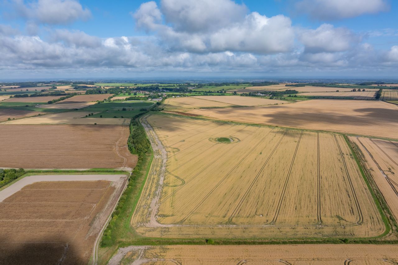
SOLD – LAND AT HACKPEN HILL, BROAD HINTON, SWINDON SN4 9NR
121.52 acres of arable land
Freehold with Vacant Possession
OFFERS IN EXCESS OF £1,500,000
M4 Jn 17 – 6.3 miles | Marlborough 6.5 miles
(All distances are approximate)
Land Details
Three fields of productive level land totalling approximately 121.52 acres (49.18 hectares) recently in combinable cropping and situated on the Wiltshire Downs.
The land is primarily Grade 2 land classification, with lime-rich loamy soils. The land benefits from good roadside access and a mixture of hedgerows and open boundaries.
Access
Access to the land is obtained from a gateway in the eastern corner leading from the public highway.
Services
A water supply was previously connected to this field and it is assumed that the supply could be reconnected. It will be the responsibility of the purchaser to investigate whether any other services can be made available.
Location
The land is located in an attractive position at the foot of the Hackpen Hill with a view of the White Horse and is marked with a red circle on the location plan overleaf.
Rights of Way and Easements
As far as we are aware there are no rights of way or easements crossing the land.
Basic Payment Scheme
The land is registered on the Rural Payments Register and historically, the Basic Payment Scheme (BPS) has been claimed. BPS and entitlements are no longer available so are not included with the sale. As the delinked payment transfer window has passed, the vendor will continue to receive the future delinked payments relating to the land.
Environmental Matters
The land is under a Higher Level Stewardship Scheme ending 31st October 2024. The land lies within a Nitrate Vulnerable Zone.
Sporting & Mineral Rights
The Sporting & Mineral Rights are in hand and included in the sale so far as they are owned.
Method of Sale
The freehold of the property is offered for sale as a whole by private treaty with vacant possession.
Viewings
Interested parties may inspect the land at any time during daylight hours provided they carry a copy of the particulars with them. Interested parties are responsible for their own safety.
Directions
From M4 Junction 17 take the B4005 towards Wroughton and turn first right into Hay Lane. Follow this road up onto the Downs and at the crossroads turn right onto the A4361. After 1.75 miles take the second turning on the left and the land is on your left after 0.25 miles.
Enquiries and Further Information
All enquiries should be made to Mark Webb or Pippa Wildern at WebbPaton, The Dairy, Hook SN4 8EF. Telephone: 01793 842055. Email: mark@webbpaton.co.uk or pippa@webbpaton.co.uk
Data Room
An online data room is available for the sale. Please contact WebbPaton for access.
SOLD – Land at Slaughterford Road, Biddestone, Wiltshire, SN14 7DB
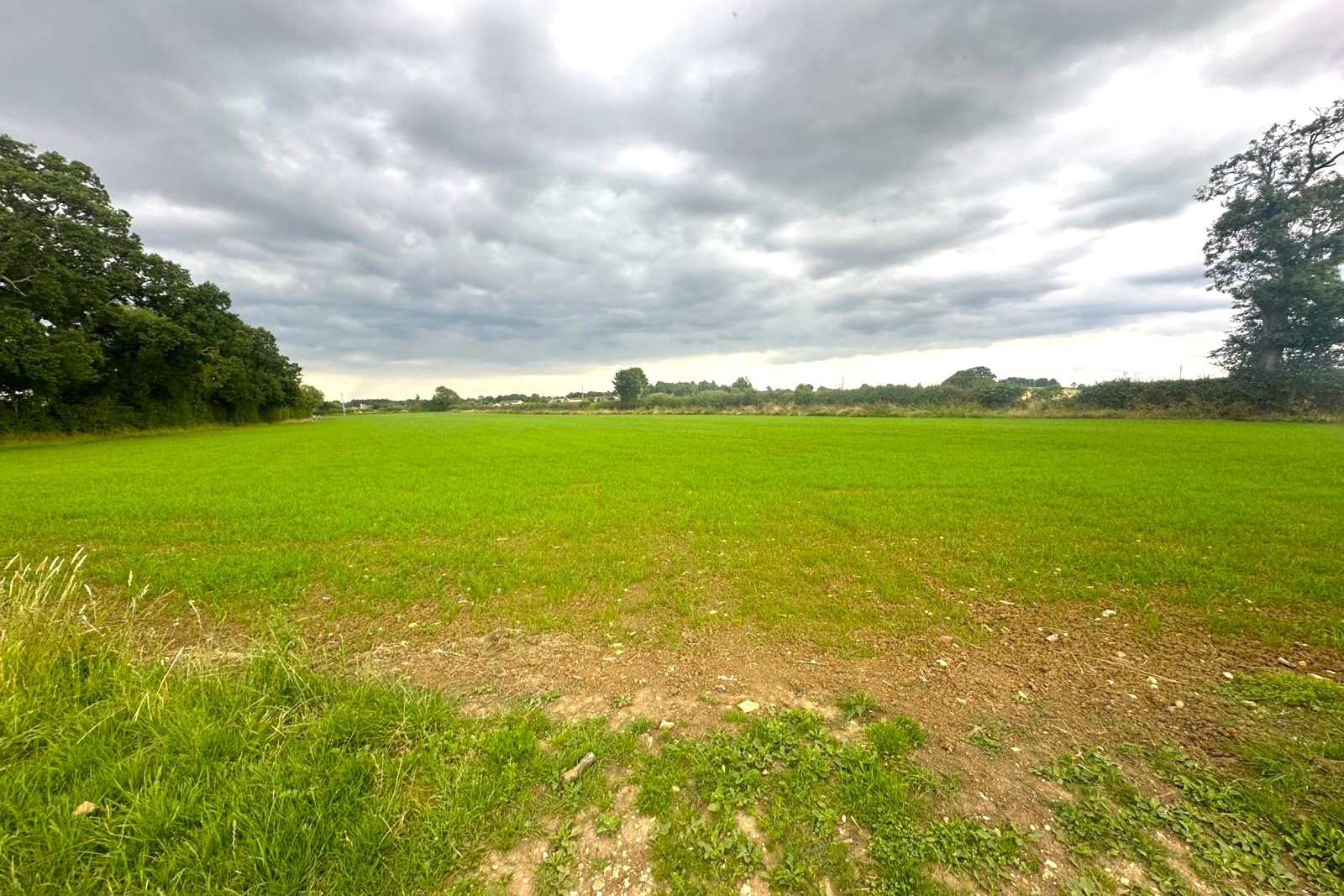
LAND AT SLAUGHTERFORD ROAD, BIDDESTONE, WILTSHIRE, SN14 7DB
(approx. postcode)
A 4.28 acre pony paddock for sale by Informal Tender – Freehold with Vacant Possession
OFFERS IN EXCESS OF £100,000
Biddestone – 0.5 miles | Chippenham – 4 miles
(All distances are approximate)
Land Details
An attractive single parcel of productive land extending to approximately 4.28 acres situated close to Biddestone, Chippenham. The land represents a range of opportunities to anyone with equestrian or amenity interests. The land benefits from mature hedgerow boundaries and direct access from the public highway. The land is classified as Grade 3 over shallow lime-rich soils over chalk or limestone.
Access
Access to the land is obtained from one gateway leading from the public highway to the south.
Services
It will be the responsibility of the purchaser to investigate whether any other services can be made available.
Location
The land is located in an attractive position, approximately 0.5 miles to the north west of Biddestone and is marked with a red circle on the location plan overleaf.
Rights of Way and Easements
A public right of way (BIDD13) crosses the land from north to south.
As far as we are aware, there are no other rights of way or easements crossing the land.
Sporting & Mineral Rights
The Sporting & Mineral Rights are in hand and included in the sale so far as they are owned.
Basic Payment Scheme
The land is registered on the Rural Payments Register and historically, the Basic Payment Scheme (BPS) has been claimed. BPS and entitlements are no longer available so are not included with the sale. As the delinked payment transfer window has passed, the vendor will continue to receive the future delinked payments relating to the land.
Environmental Matters
The land has not been included within any environmental stewardship agreements.
Land Schedule
National Grid No: ST8573 9589
Hectares: 1.73
Acres: 4.28
Method of Sale
The freehold of the property is offered for sale as a whole by Informal Tender. All offers must be submitted in writing on the Tender Offer form to felicity@webbpaton.co.uk by 12pm on Friday 30 August 2024.
Viewings
Interested parties may walk the land at any time during daylight hours provided they carry a copy of the particulars with them. Interested parties are responsible for their own safety.
Directions
From Biddestone, head north along Cuttle Lane, bare left heading towards West Yatton. Take the next left and the land will be found on the left hand side and will be marked with a ‘For Sale’ board.
Enquiries and Further Information
All enquiries should be made to Felicity Wright or Laura Carpenter at WebbPaton. Telephone: 01793 842055. Email: felicity@webbpaton.co.uk or laura@webbpaton.co.uk
Uplift/Development Clause
The property will be sold subject to an uplift clause whereby the current vendors will receive 30% of any increase in value upon the granting of planning permission for residential development over a period of 25 years, from when the property is sold.
Agent Note
The vendor is not obliged to accept the highest or indeed any offer for the land. The gateway between this parcel and the adjacent parcel will be closed up by the vendors.
Data Room
An online data room is available for the sale. Please contact WebbPaton for access.
SOLD – Land at Bagbury Lane, Lydiard Millicent, Swindon, SN5 4LX

SOLD
LAND AT BAGBURY LANE, LYDIARD MILLICENT, SWINDON, SN5 4LX (approx. postcode)
A 2.94 acre pony paddock for sale by Informal Tender – Freehold with Vacant Possession
OFFERS IN EXCESS OF £65,000
Lydiard Millicent – 1.5 miles | Royal Wootton Bassett – 3 miles (all distances are approximate)
Land Details
An attractive single parcel of productive land extending to approximately 2.94 acres situated close to Lydiard Millicent, Wiltshire. The land represents a range of opportunities to anyone with equestrian or amenity interests. The land benefits from mature hedgerow boundaries, some stock fencing and direct access from the public highway. Mains water is connected. The land is classified as Grade 3 over lime-rich loamy and clayey soils.
Access
Access to the land is obtained from one gateway leading from the public highway to the south.
Services
A water trough is located on the eastern boundary. It will be the responsibility of the purchaser to investigate whether any other services can be made available.
Location
The land is located in an attractive position, approximately 1.0 mile east of the village of Lydiard Millicent and is marked with a red circle on the location plan overleaf.
Rights of Way and Easements
As far as we are aware, there are no other rights of way or easements crossing the land.
Sporting & Mineral Rights
The Sporting & Mineral Rights are in hand and included in the sale so far as they are owned.
Tenancy Matters
The land is currently let on an annual grazing agreement to a neighbouring farmer. The agreement expires on 31 October 2024.
Land Schedule
National Grid No: SU0886 4574
Hectares 1.19
Acres 2.94
Method of Sale
The freehold of the property is offered for sale as a whole by Informal Tender. All offers must be submitted in writing on the Tender Offer form to felicity@webbpaton.co.uk by 12pm on Tuesday 13th August 2024.
Viewings
Interested parties may walk the land at any time during daylight hours provided they carry a copy of the particulars with them. Please be aware that cattle may be grazing the land at the time of viewings. Interested parties are responsible for their own safety.
Directions
From Purton, head south on Restrop Road towards Royal Wotton Bassett. After approximately 0.5 miles turn left onto Bagbury Lane. Follow the road for approximately 0.3 miles and the field will be on the left hand side and will be marked with a ‘For Sale’ board.
Enquiries and Further Information
All enquiries should be made to Felicity Wright or Laura Carpenter at WebbPaton. Telephone: 01793 842055. Email: felicity@webbpaton.co.uk or laura@webbpaton.co.uk
Data Room
An online data room is available for the sale. Please contact WebbPaton for access.
SOLD – Land at Witcomb, Hilmarton, Calne, Wiltshire, SN11 8TA
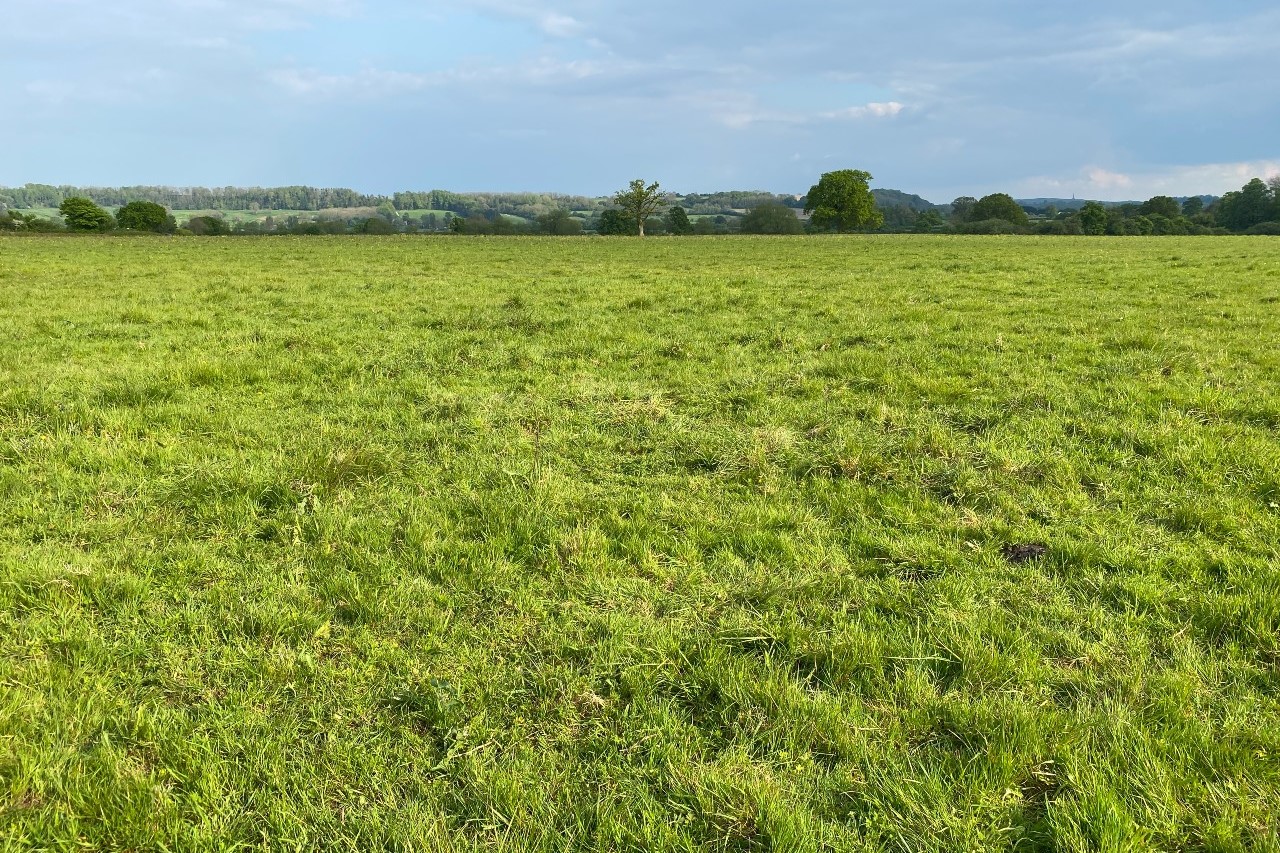
SOLD – LAND AT WITCOMB, HILMARTON, CALNE, WILTSHIRE, SN11 8TA (approx. postcode)
45.59 acres of pasture with arable potential, includes small area of woodland
Freehold with Vacant Possession
OFFERS IN EXCESS OF £600,000
Calne – 3 miles | Royal Wootton Bassett – 5 miles (all distances are approximate)
Land Details
A single parcel of productive land extending to approximately 45.59 acres, mostly down to pasture with a small area of woodland. The pasture extends to approximately 42.25 acres and whilst currently down to a grass ley planted in 2015, it has previously been planted to maize and used for whole crop cereals. It is classified as “arable” with the Rural Payments Agency. The land has been farmed organically for over 20 years and a soil test undertaken in 2022 indicated high organic matter content. The adjoining woodland extends to approximately 3.33 acres.
The land is primarily Grade 3 land classification with a small area of Grade 4 to the east, over base-rich loamy and clayey soils. The land benefits from good roadside access, fencing, a mature hedgerow to the west, and a mains water connection.
Access
Access to the land is obtained from two gateways leading from the public highway to the north.
Services
A water trough is located to the north of the land with a mains water metered connection located on the boundary with the Bushton Road. It will be the responsibility of the purchaser to investigate whether any other services can be made available.
Location
The land is located in an attractive position, approximately 1.5 miles east of the village of Hilmarton and is marked with a red circle on the location plan overleaf.
Rights of Way and Easements
Footpath HILM1 runs diagonally across the land shown in blue on the plan overleaf. A government oil pipeline runs across the land which includes rights to maintain and use. As far as we are aware, there are no other rights of way or easements crossing the land.
Sporting & Mineral Rights
The Sporting & Mineral Rights are in hand and included in the sale so far as they are owned.
Basic Payment Scheme
The land is registered on the Rural Payments Register and historically, the Basic Payment Scheme (BPS) has been claimed. BPS and entitlements are no longer available so are not included with the sale. As the delinked payment transfer window has passed, the vendor will continue to receive the future delinked payments relating to the land.
Environmental Matters
The land is under a Mid-Tier Countryside Stewardship Scheme ending 31st December 2026, under the option OT3: Organic land management – rotational land, which brings in an annual income of £2,254.94. This scheme can either be transferred to the purchaser or terminated. The land lies within a Nitrate Vulnerable Zone.
Method of Sale
The freehold of the property is offered for sale as a whole by private treaty with vacant possession.
Viewings
Interested parties may walk the land at any time during daylight hours provided they carry a copy of the particulars with them. Please be aware that cattle may be grazing the land at the time of viewings. Interested parties are responsible for their own safety.
Directions
From the A3102, head east at the T-junction heading to Compton Bassett. Take the second left towards Bushton, follow the road for 0.7 miles then take the first left. The field is on your left hand side, where you will find two gateways.
Enquiries and Further Information
All enquiries should be made to Helen Wiltshire or Laura Carpenter at WebbPaton. Telephone: 01793 842055. Email: helen@webbpaton.co.uk or laura@webbpaton.co.uk
Data Room
An online data room is available for the sale. Please contact WebbPaton for access.
SOLD – Valley View, West End, Marshfield, South Gloucestershire, SN14 8JH

SOLD – Valley View, West End, Marshfield, South Gloucestershire, SN14 8JH
Bath – 8 miles, Chippenham – 10 miles, M4 J18 – 5.6 miles, Chippenham Station to London Paddington in 70 minutes – 9.5 miles
(Distances are approximate)
Available as a whole
Offers in Excess of £595,000
FOR SALE
The property includes a modern well-presented three-bedroom house and an adjoining paddock, extending to approximately 5.19 acres in total. The house is subject to an Agricultural Occupancy Condition.
THE HOUSE
Valley View is an attractive detached house situated in the sought after village of Marshfield. The property is built of stone and positioned in a large plot with surrounding gardens and attractive views over the rolling countryside.
The property offers in excess of 1,400 sq ft of accommodation arranged over two floors. The ground floor comprises a large open plan kitchen with a breakfast bar and dining area. A doorway leads into the useful utility space and downstairs WC. On the opposite side of the hall is a cosy living room and conservatory which provides direct access into the garden.
A staircase rises to the first floor where there are three double bedrooms and a family bathroom. The larger bedrooms have fitted wardrobes and all rooms enjoy attractive rural views. There is double glazing throughout.
OUTSIDE
To the front of the property is a large driveway providing off-roading parking for several cars.
The large garden is well-maintained and surrounds the property on all elevations. It is mainly laid to lawn with a mature hedge.
PADDOCK
There is a paddock adjoining the garden to the rear of the property, extending to approximately five acres. This is a grass field surrounded by mature hedgerows and stock-proof fencing. Access can be obtained directly from the property.
The paddock provides a range of opportunities to anyone with equestrian or amenity interests subject to the necessary planning permissions.
SITUATION
Valley View is situated in a quiet, rural position in the Cotswolds Area of Outstanding Natural Beauty. A particular feature of the property are the generous views overlooking the surrounding landscape and farmland.
The property lies a few miles south of the M4 Junction 18 and just to the north of Marshfield, which provides access to local services and amenities. The hamlet of West End is accessed via a no-through road, making it a peaceful position for the handful of properties located there.
The historic city of Bath is located nearby and is famous for its excellent cultural and leisure amenities including museums, art galleries and theatres, as well as restaurants, bars and cafés. There are also a highly regarded range of private and state schools, catering
for all age groups, within easy reach.
There are high-speed train services operating from both Chippenham and Bath station, with direct access to London Paddington.
ADDITIONAL INFORMATION
METHOD OF SALE
Valley View is offered for sale as a whole by private treaty.
TENURE AND POSSESSION
The property is offered for sale freehold with vacant possession on completion.
DATA ROOM
An online data room has been set up and will be password protected providing access to all relevant documentation relating to the property. Details of access will be provided by the vendor’s agents; however, buyers are encouraged to make their own enquiries to satisfy any queries arising.
EASEMENTS, WAYLEAVES AND PUBLIC RIGHTS OF WAY
There are no public rights of way crossing this property. The property will be sold subject to, or with the benefit of all Wayleaves, Easements, Quasi Easements, Rights of Way, Covenants and Restrictions whether mentioned in these particulars or not.
LOCAL AUTHORITY
The relevant local authority is South Gloucestershire Council.
COUNTRYSIDE STEWARDSHIP SCHEME
The paddock to the rear of the property is subject to a Mid-Tier Countryside Stewardship Scheme running until 31st December 2027. The vendor will transfer the agreement to the purchaser if required. Further details are in the dataroom.
FIXTURE AND FITTINGS
All fixtures, fittings and chattels, whether referred to or not, are specifically excluded from the sale, including carpets, curtains, light fittings, freestanding domestic and electrical items, and garden machinery.
SITE PLANS
These are based on the Ordnance Survey and are for reference only. They have been checked and completed by WebbPaton LLP and the purchaser will be deemed to satisfy themselves as to the description of the property. Any error or misstatement shall not annul the sale nor entitle either party to compensation in respect thereof.
COUNCIL TAX
Valley View is in Band C.
SERVICES
It is understood that the property is connected to a mains electricity supply and benefits from a good broadband connection. Please refer to the water plan documents in the data room for information on the main and borehole water services available at the property. The buyer will be required to make a new connection to the mains water supply at their own cost. Drainage is via a private septic tank.
DIRECTIONS
From the M4, take the A46 at Junction 18 towards Bath. Continue on the A46 for nearly 4 miles and then at the roundabout take the first exit onto the A420. After 2 miles turn left onto Bonds Lane and keep to the left of the fork when the road splits. The property is located to the right.
AGRICULTURAL OCCUPANY CONDITION
Planning was granted in 1996 for an Agricultural Worker’s Dwelling and therefore the property is subject to an Agricultural Occupancy Condition.
VIEWINGS
All viewings are strictly by prior appointment. Please contact Pippa Wildern or Mark Webb at WebbPaton LLP on 01793 842055 or post@webbpaton.co.uk.
SOLD – Rectory Farm, Ogbourne St George, Marlborough, Wiltshire, SN8 1SL

SOLD – Rectory Farm, Ogbourne St George, Marlborough, Wiltshire, SN8 1SL
Marlborough – 3.3 miles
M4 Junction 15 – 4.1 miles
Swindon Train Station – 7.4 miles
Offers in excess of £1,300,000
Available as a whole or in two lots
Introduction
Rectory Farm sits in an exceptional position, located within the picturesque village of Ogbourne St George, Marlborough. The property provides an exceptional opportunity to purchase a period farmhouse with adjoining land, which could lend itself to various alternative uses (subject to planning). Rectory Farm includes a four-bedroom farmhouse, a small range of outbuildings and approximately 16.29 acres of permanent pasture. In total the whole extends to 17.04 acres.
With potential to substantially renovate and remodel the farmhouse (subject to planning), Rectory Farm provides an opportunity to create an exceptional family home with plenty of scope and space to extend and enhance.
Situation
Rectory Farm sits within Ogbourne St George, a village close to Marlborough, which sits within the beautiful North Wessex Downs Area of Outstanding Natural Beauty.
With beautiful views overlooking the Downs to the rear of the property, Rectory Farm benefits from being in a village location whilst being adjoined by a decent size block of land which allows for plenty of space and privacy.
Given Rectory Farm’s position, it is within easy reach of the vibrant market town of Marlborough, this being a 10 minute drive away. Marlborough offers a very good choice of shopping and amenities, accompanied by excellent restaurants and cafes. There are a range of particularly good schools in the local area with the prestigious Marlborough College being located within the town itself. The property is extremely well connected being 10 minutes from Junction 15 of the M4 and the A419, which leads to the M5. Trains to London Paddington go from Swindon, Great Bedwyn and Hungerford (a rail journey of an hour or less).
Lot 1 – Guide Price £1,050,000
The farmhouse is an attractive, period farmhouse constructed of red brick, under a tiled roof. On the ground floor the property comprises a kitchen and sitting room whilst to the rear there are various utility and storage rooms. On the first floor the landing leads to a family bathroom and two double bedrooms (one of which has an ensuite). The second floor consists of two further rooms which are under the eaves with dormer windows. These two rooms could be made in to two further bedrooms but are not currently fully converted. Outside there is a large and well maintained garden, which is approximately 0.75 acres.
The farmhouse is in need of renovation and updating but offers a rare and exciting opportunity to reconfigure and extend the property to create an excellent family home. The Gross Internal Area extends to approximately 292.70 m² (3,442.70 ft²) which includes the basement.
There is a small range of breeze block constructed, single storey outbuildings situated to the side of the farmhouse. These buildings could be repurposed for alternative uses, subject to planning. A yard area is also situated to the side of the farmhouse, providing plenty of space for off road parking. The outbuildings extend to approximately 49.6 m² (534 ft²). Accompanying Lot 1 is a level paddock extending to 4.65 acres in total. This paddock is directly to the rear of the garden and can be accessed via an established entrance to the side of Rectory Farmhouse. Boundaries are either fenced or marked by hedgerows. At the bottom of this paddock is a timber field shelter and a small redundant yard which is currently surrounded by breeze block walls.
Lot 2 – Guide Price £250,000
Lot 2 consists of two paddocks of permanent pasture, extending to 11.64 acres in total. The land is mainly level albeit, in field SU1974 7128 the land slopes gently upwards to the northeast. Lot 2 benefits from a separate vehicular access in the north corner of field SU1974 6239, directly off the public highway.
The land is Grade 3 quality and is bordered by the River Og to the south. The land presents a potential range of opportunities to anyone with equestrian or amenity interests, subject to the relevant planning permissions. The land is not subject to any environmental schemes.
Overage
It should be noted that if the property is sold as a whole, the sale will be subject to an overage which will be triggered if any residential development is granted planning permission on the land. We envisage this overage being 30% of the uplift in value for a 20-year period. The overage will not be triggered if any development takes place on the existing farmhouse or buildings.
Method of Sale
The property is offered for sale as a whole or in two lots by private treaty.
Tenure and Posession
The property is offered for sale freehold with vacant possession on completion.
Services
It is understood the farmhouse is connected to a mains water supply, mains electric and benefits from a good broadband connection. There is a private drainage connection and oil-fired central heating. The land benefits from a private water supply.
Council Tax & Local Authority
The farmhouse is in Band F for Council Tax purposes. The relevant local authority is Wiltshire Council at https://www.wiltshire.gov.uk/
Public Rights of Way
There is a public footpath situated along the northeast border of SU1974 7128 and SU1974 8728. There are no other public rights of way affecting the property.
Directions
Rectory Farm is located in the centre of Ogbourne St George on the High Street. The postcode is SN8 1SL. A WebbPaton ‘For Sale’ board will be located at the front of Rectory Farmhouse with another board located at the separate entrance to Lot 2.
Viewings
All viewings are strictly by appointment only. Viewings should be arranged through WebbPaton on 01793 842055.
SOLD – Land at Poulshot, Poulshot Road, Devizes, Wiltshire, SN10 1RY
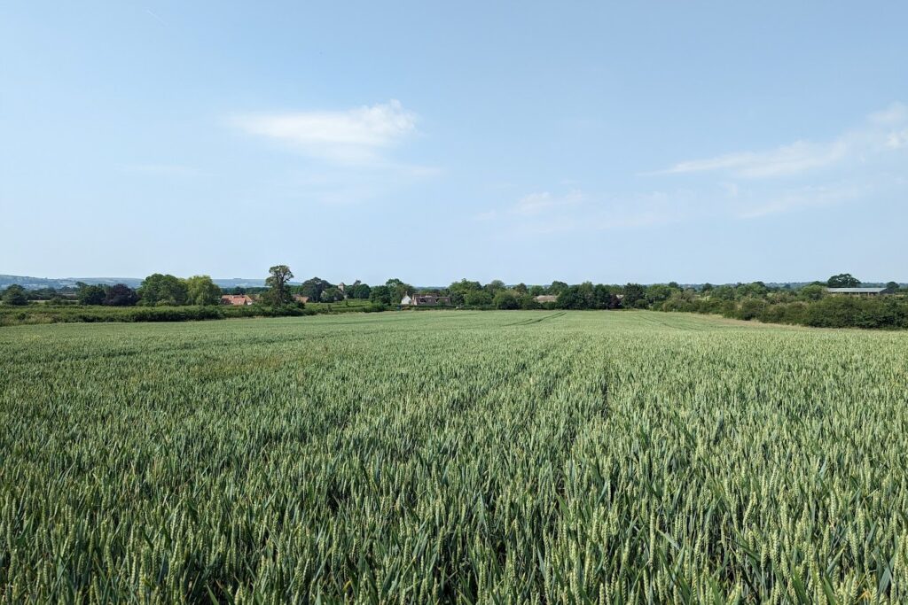
SOLD – Land at Poulshot, Poulshot Road, Devizes, Wiltshire, SN10 1RY
Lot 1 – 11.80 acres of permanent pasture
Lot 2 – 13.77 acres of arable land
Offers invited in excess of £120,000 for Lot 1 and £165,000 for Lot 2
Land Details
WebbPaton are delighted to bring to the market approximately 25.57 acres of land situated within the idyllic village of Poulshot, in the heart of the North Wessex Downs AONB. Available as a whole or in two separate Lots. A unique opportunity to continue to farm the land or explore other alternative uses. Lot 1 consists of one field of permanent pasture extending to approximately 11.80 acres, whilst in a separate block, Lot 2 comprises two fields of gently sloping arable land. The land would suit a range of uses for the right buyer given its position within the beautiful village of Poulshot. The land is classified as a mix of Grade 2 and 3, capable of growing good quality arable and forage crops. There would be the ability to convert the arable land to grass if required. The land can be seen more clearly outlined on the plan overleaf.
Access
Both Lots benefit from good access, this being off the main public highway known as Poulshot Road. Lot 2 also benefits from a separate access via a right of way across a neighbouring property. Please see the exact route identified in blue on the plan overleaf.
Method of Sale
The freehold of the property is offered for sale by private treaty with vacant possession.
Rights of Way
Parcel ST9659 7110 has a public footpath (POUL27) crossing it. As far as we are aware, there are no other rights of way crossing the land.
Services
A water trough is located at the access of Lot 1 with a mains water connection. It will be the responsibility of the purchaser to investigate whether any other services can be made available. We understand the relevant wayleaves and easements are in place regarding existing pipes and overhead lines crossing the property. For further details please speak to WebbPaton.
Environmental Matters
Lot 1 forms part of a Countryside Stewardship Mid-tier agreement which ends in December 2027. This can be terminated if required. Lot 2 is not currently entered under any agri-environment scheme.
Holdover
Depending on the date of completion, there are holdover rights that may be required in order to harvest the Winter Wheat crop.
Overage
Lot 2 will be subject to an overage equating to 20% of any uplift in value for a 25 year period from the date of completion. This uplift will be payable by the buyer to the vendors on the implementation of planning permission for any residential development on the land.
Viewings & Directions
Interested parties may walk the land at any time during daylight hours provided they carry a copy of these particulars with them. When walking Lot 2 please be mindful of the Winter Wheat planted and use the tramlines or edge of the field where possible. Please access each Lot where the WebbPaton ‘For Sale’ boards are located. The nearest postcode is SN10 1RY.
Enquiries and further information
All enquiries should be made to Pippa Glanville or Libby Barron at WebbPaton.
SOLD – Whitleyford Farm Cottage, Shay Lane, Forton, nr Newport, Staffordshire, TF10 8DL
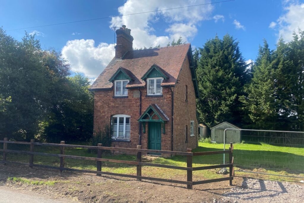
FOR SALE BY INFORMAL TENDER – TENDER DEADLINE: 12 NOON ON WEDNESDAY 7TH DECEMBER 2022
Residential Dwelling with Planning Permission for Extension at Whitleyford Farm Cottage, Shay Lane, Forton, near Newport, Staffordshire, TF10 8DL
OFFERS IN EXCESS OF: £220,000
- Planning permission to extend into an attractive family home
- Proposed Gross Floor Area: 129.08 sqm (1,389 sqft)
- Detached traditional cottage
- Attractive rural location
- Good sized garden
- Off road parking
A41– 3 mins, M6 J14 – 19 mins, M54 J3 – 22 mins, Newport – 2.5 miles, Telford Railway Station – 9 miles, Stafford – 10 miles
DESCRIPTION
A unique opportunity to purchase a charming three bedroom detached property with planning permission to renovate and extend to create a spacious family home. The property is set centrally within a garden laid to lawn, in a plot of approximately 0.22 acres. There are two garages to the rear of the property providing external storage.
Constructed in 1901, Whitleyford Farm Cottage is a traditional period cottage with views over open countryside. The cottage is built of red brick under a clay tile pitched roof, with single glazed wooden windows. The property has been vacant for some time and offers huge potential for modernisation throughout.
On the ground floor, the property comprises a front entrance hall, living room, kitchen/dining room, bathroom, separate WC and store to the rear. To the first floor are three bedrooms around a small central landing. The current Gross Floor Area of the property extends to approximately 92.86 sqm (999 sqft).
LOCATION
Forton is a small rural village on the Staffordshire/Shropshire border with a local 14th century parish church and surrounded by open countryside. The neighbouring market town of Newport is approximately 2.5 miles to the south, providing an excellent selection of amenities including schools, shops, restaurants, cafes, pubs and hotels. All sports and interests are catered for whilst the town also benefits from stand out features such as Chetwynd Deer Park and the nearby ruins of Lilleshall Abbey.
The surrounding Staffordshire and Shropshire countryside offers plenty of opportunities for walking and cycling on the quiet lanes and a network of scenic footpaths. There are a number of highly regarded schools in the area, both state and independent, including Newport Girls’ High School, Haberdashers’ Adams (the former Adams Grammar School), Burton Borough School, Stafford Grammar School, St Dominics at Brewood, and Castle House School. Harper Adams University is located in nearby Edgmond.
The cottage benefits from fantastic transport links to further afield, ideally located within two miles of the A41, to allow easy access to the larger towns of Stafford, Telford and Shrewsbury and being within 20 minutes of the M6 and M54 motorways. The excellent rail connections from Telford and Stafford mean Birmingham and Manchester are in commutable distance.
PLANNING
Stafford Borough Council granted full planning permission for Demolition of existing extension, creation of new extension to dwelling and minor alteration to access (resubmission of 13/19312/HOU) on the 21st February 2020. The planning documents can be found on Stafford Borough Council’s planning website under reference number 19/31550/HOU. The planning was implemented in September 2022, through addition of the new access and setting back of the visibility splay. This has been confirmed in writing to Stafford Borough Council.
The permitted works create a more suitable family home, by removing the existing dilapidated side extension and combining the current kitchen and store to create a separate dining room. The new side extension will house a separate kitchen, utility and downstairs bathroom. On the first floor the existing layout will be rearranged to create a good sized landing leading to two double bedrooms and an upstairs family bathroom, with the extension housing the master bedroom and en-suite.
Further details, including planning documents, can be found on WebbPaton’s online data room which can be found at www.whitleyfordfarmcottage.co.uk. To access the data room please contact WebbPaton.
ACCESS
Whitleyford Farm Cottage is accessed from a private driveway leading directly from Shay Lane. This access has been recently installed, as implementation of the planning permission. This has created a considerably safer access with much improved visibility than the previous access. The new access is indicated by the red arrow on the plan in the particulars. The proposed access is to be constructed of block paving.
METHOD OF SALE
The property is offered for sale as a whole by informal tender. Written or email offers are to be sent to WebbPaton’s office by 12 noon on Wednesday 7th December 2022. Offers should be submitted by email to helen@webbpaton.co.uk or in a sealed envelope to the WebbPaton office, address below, and marked “For the attention of Helen Wiltshire – Whitleyford Farm Cottage – Tender.
Offers should include the offer amount, how the purchase will be funded, whether the transaction would be related to the sale of another property and solicitor details.
COMMUNITY INFRASTRUCTURE LEVY (CIL)
There is no Community Infrastructure Levy (CIL) due to Stafford Borough Council for Whitleyford Farm Cottage. This has been confirmed in writing.
SERVICES
Mains water and electricity connections are available. Drainage from the cottage is to a private septic tank drainage system. Potential purchasers are to make their own enquiries.
WEBBPATON DATAROOM
An online data room is available at www.whitleyfordfarmcottage.co.uk. Please contact WebbPaton for the password to access this site.
FURTHER INFORMATION & VIEWINGS
All viewings are to be arranged through WebbPaton.
SOLD – The Granary, Home Farm, Knowle, Solihull, B93 0AB
SOLD – THE GRANARY
HOME FARM, KNOWLE, SOLIHULL B93 0AB
OFFERS OVER £250,000 INVITED
- Prior Approval granted to convert an agricultural building into a four bedroom dwelling
- Gross Internal Area of proposed dwelling – 294.18m2 (3166ft2)
- Site extends to approximately 0.19 acres
- KNOWLE – 1 MILE
- M42 J5 – 2 MILES
- BIRMINGHAM AIRPORT – 7 MILES
FOR SALE
A unique opportunity to acquire an agricultural barn with planning permission to convert into a contemporary four bedroom residential dwelling with garden, in all extending to approximately 0.19 acres.
SITUATION
The barn lies in and overlooks open countryside on the edge of Knowle. The barn is located off Kenilworth Road, east of Knowle, and within easy reach of Solihull and Birmingham, which offer an excellent range of restaurants, shops and commercial services. Knowle is a thriving village with two schools, church, high street with a range of shops, library and bus services. The property is well connected being 5 minutes from M42 Jn 5.
THE GRANARY
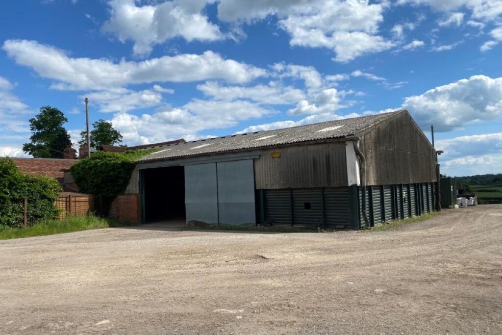
The Granary is a steel portal framed agricultural barn. Prior approval was renewed on 5th July 2021 by Solihull Metropolitan Borough Council (application reference PL/2021/01428/PNCUDW) to convert the barn into a large four bedroom dwelling with en-suites serving each bedroom, family bathroom, separate W/C and utility room. There is also a spacious open plan kitchen/diner and separate lounge with large glass patio doors overlooking open countryside. Furthermore there is an internal garage included in the design.
The plans incorporate the existing steel portal frame, replacing the existing roof with clay tiles and the walls with a mixture of brick work, glass panelling and timber cladding to provide a modern dwelling. The ground floor area of the dwelling measures 294.18m2 with the curtilage providing additional car parking space and garden area to take in the wonderful views. In total The Granary site extends to approximately 0.19 acres as shown shaded yellow on the plan overleaf.
TENURE AND POSSESSION
The property is offered for sale freehold with vacant possession on completion.
SERVICES
Mains water and electricity connections are available. The buyer will be offered the option to connect to the existing water and electric supplies at Home Farm and will be responsible for installing their own meters at their own cost. There is the opportunity to install a septic tank on the site indicated on the plan which is owned by the Vendor. All interested parties are advised to make their own enquires.
COMMUNITY INFRASTRUCTURE LEVY (CIL)
The CIL payable to Solihull Borough Council for The Granary is nil. All interested parties are advised to make their own enquires and familiarise themselves with the relevant CIL forms which are to be submitted to Solihull Borough Council.
ACCESS / RIGHT OF WAY
Home Farm is currently accessed via a right of way over the drive shaded yellow owned by a third party and is subject to maintenance contributions. Planning permission was granted on 15th February 2021 by Solihull Borough Council under planning reference PL/2020/01514/PPFL to create a new separate access for Home Farm on land owned by the Vendor. Under the planning permission for The Granary the new owner is required to switch to the new access drive at Home Farm on occupation of the dwelling. The drive, single track with passing places and a 60mm tarmac surface, will be built at the Vendor’s expense in the next few months. A right of way will be granted over the new drive (hatched on the plan) and through the farmyard owned by the Vendor, as shown shaded brown on the plan above, which will again be subject to maintenance contributions.
DIRECTIONS
From M42 Jn 5 head south towards Knowle on the A414/Warwick Road. At the roundabout take the second exit. After approximately 0.6 miles, as you approach the end of Knowle High Street, bear left onto the B4101/Kenilworth Road signposted for Temple Balsall. The turning for Home Farm is on your right, about 250m after crossing the Grand Union Canal, and opposite the turning to Barston. Follow the drive to Home Farm (do not bear left to Knowle Hall or The Stables).
VIEWINGS
Home Farm is a working farm currently occupied by a third party. There is strictly no access to the farmyard unless via prior appointment. All viewings must be made strictly by appointment arranged through Tracey Butler at WebbPaton on 01793 842055.
METHOD OF SALE
The freehold of the Property is offered for sale by private treaty with vacant possession upon completion.
DATA ROOM
An online data room is available for the sale providing further information and planning documents. Please contact WebbPaton for access.